Mines and Steel
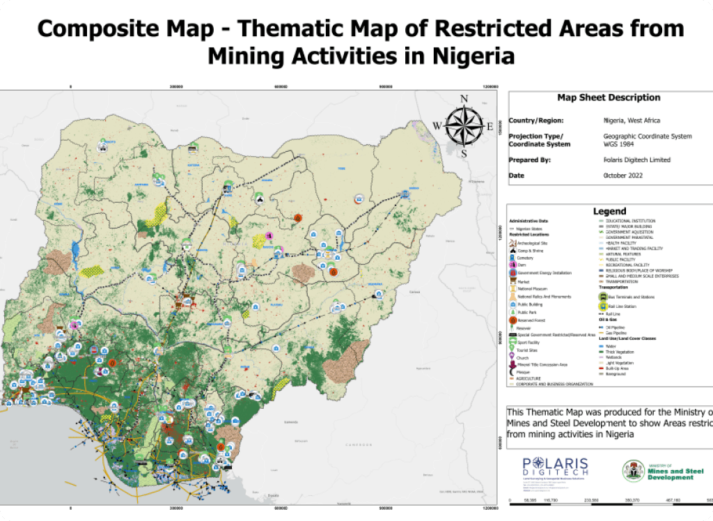
Production Of Thematic Mapping of Areas Restricted (Protected) From Mining Activities
in Nigeria for Integration into the Nigeria Mining Cadastre Digital Database
Project Overview
Polaris Digitech Limited is proud to collaborate with the Federal Ministry of Mines and Steel to bring about the project of Mines and Steel. The objective of this project is to create a thematic map of areas restricted or protected from mining activities in Nigeria. This thematic map will be integrated into the Nigeria Mining Cadastre Digital Database. Our team of experts is equipped with the latest technology and tools for collecting and analyzing data for the purpose of producing an accurate and reliable thematic map. The data we collect will be analyzed to highlight areas that are restricted or protected from mining activities in Nigeria.
This is important because mining activities can have a negative impact on the environment and communities within mining areas. Through this project, we hope to contribute to the development of a sustainable mining industry in Nigeria. We believe that our work will help to ensure that mining activities are carried out in a responsible and environmentally friendly manner. Ultimately, our goal is to help create a balance between economic growth and environmental sustainability in the mining sector. Our team is committed to delivering high-quality results within the given timeframe. We are confident that our expertise, combined with the support of the Federal Ministry of Mines and Steel, will lead to a successful and impactful project.